
Tromelin
The tiny island claimed by two countries
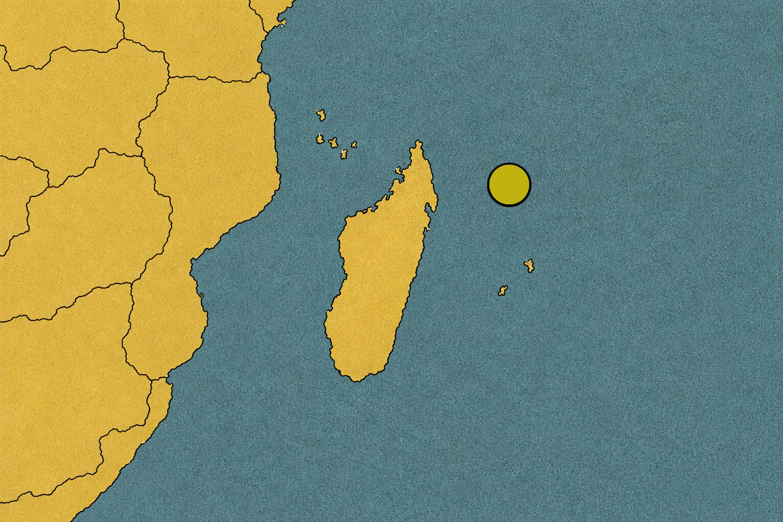
In the middle of the Indian Ocean, there is an island so small that it is hard to find on a map. It has no big cities, roads, or permanent population. Yet, it appears in a territorial dispute between two countries: France and Mauritius. How can a tiny piece of sand and coral cause a disagreement that has lasted for decades?
The answer is not only in the land you can see from the beach. It is also in colonial history, old documents, and the waters surrounding the island. Because, in today’s world, controlling a territory can also mean claiming rights over a huge expanse of sea and its resources.[1][2]
A tiny island in the Indian Ocean
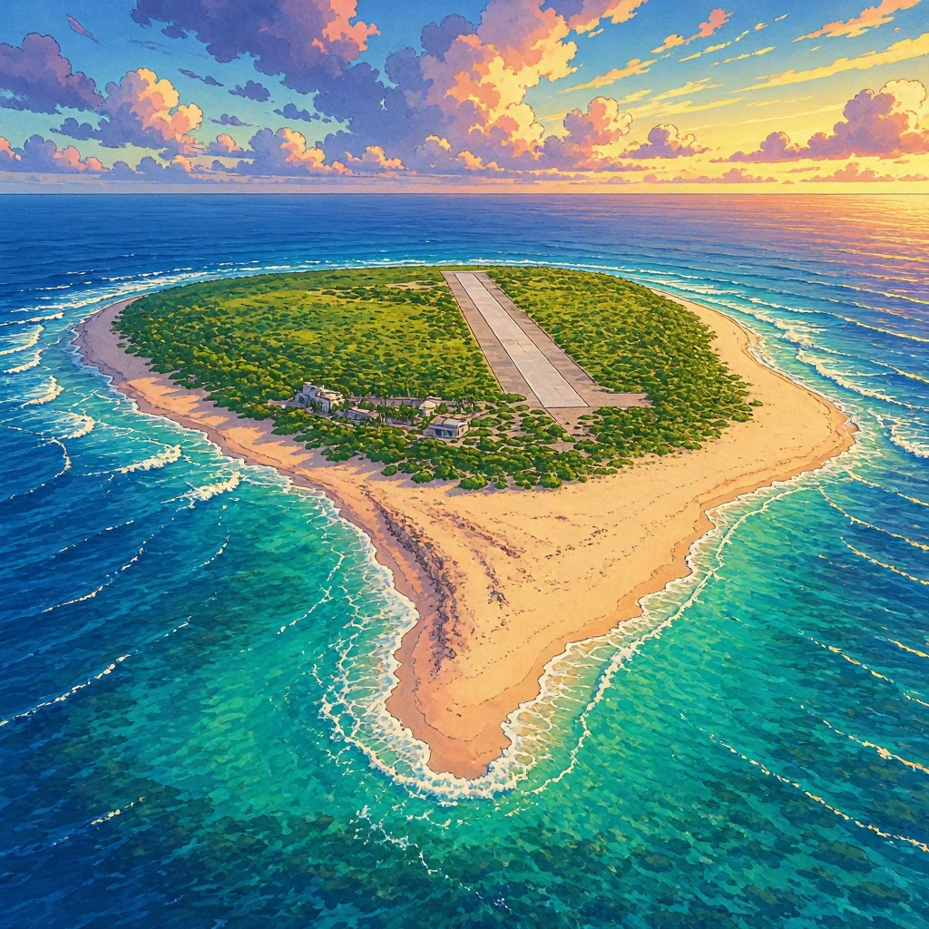
Tromelin is a coral islet of about one square kilometer, located east of Madagascar and north of Mauritius and Réunion. It is low, sandy, and exposed to winds and tropical storms. It has no city or permanent population: among its facilities, a weather station stands out.[2][3]
At first glance, it might seem like an unimportant place. But look at a map of the Indian Ocean: an island located in the middle of those waters can also serve as a reference point to claim maritime rights. Therefore, the dispute is not only about who owns the tiny surface of land, but also about what rights each country has in the surrounding sea.[1][2]
Who controls Tromelin today?
France administers Tromelin as part of the French Southern and Antarctic Lands, known by their acronym TAAF. The French administrative presence was reinforced in 1954, when a weather station was installed there. France considers that it has sovereignty over the island and exercises administrative functions on it.[2][4]
But there is an important difference between administering a place and having all countries accept that it belongs to you. Mauritius does not recognize French sovereignty over Tromelin and maintains its own claim. Therefore, the island is under French administration, but its sovereignty remains disputed between the two States.[1][5]
Why does Mauritius claim it?
To understand this, we have to go back to the time when European powers controlled territories and shipping routes in different parts of the world.
Mauritius was under French rule and later passed into British hands. In 1814, the Treaty of Paris confirmed the cession of Mauritius to Great Britain. The interpretation of which islands and territories were included in that cession is one of the historical issues related to the Mauritian claim over Tromelin.[2][6]
Mauritius maintains that Tromelin is part of its territory. France, on the other hand, bases its position on the history of French presence and the acts of administration it has carried out on the island. The two countries interpret the historical and legal background differently, and neither has dropped its claim.[2][5]
Independence did not end the disagreement
Mauritius became independent from the United Kingdom in 1968. However, independence did not resolve the issue of Tromelin. Mauritius began to formally claim the island in the following decade and has reiterated its position in international communications.[2][7]
Since then, the disagreement has continued through diplomatic statements and negotiations. It is not a war over the island: France and Mauritius maintain relations and have sought ways to cooperate, although they still disagree on who should have sovereignty.
The true value of the waters
Why argue so much over such a small territory? One of the keys lies in the sea.
According to international rules of the law of the sea, islands can generate certain maritime zones where a State has rights and responsibilities. In some of these zones, rights may include the exploration and use of natural resources, such as fisheries resources. The specific limits depend on applicable rules and geographic and legal circumstances.[1][8]
Therefore, the dispute over Tromelin also affects the surrounding waters. France claims maritime rights linked to the island, while Mauritius rejects that claim and states that those areas belong to it as well. It is not just a question of drawing a border around the beach: it is about establishing which country can exercise rights over the sea.[1][5]
Have they tried to reach an agreement?
Yes. In 2010, France and Mauritius signed a framework agreement to cooperate in the economic, scientific, and environmental management of Tromelin and nearby waters. The proposal included areas such as fishing, environmental protection, and archaeological research.[2][6]
The idea was practical: even if the countries did not agree on sovereignty, they could try to work together on matters of common interest. But the agreement did not resolve the question of who owns the island. Furthermore, French parliamentary documents indicate that the implementing agreements never entered into force, so signing the agreement should not be confused with a definitive solution to the dispute.[1][2]
An island with a human history
Tromelin also holds a painful history that helps us understand its past. In July 1761, the French ship L’Utile was wrecked on the island’s reefs. On board were French sailors and Malagasy people who had been enslaved and transported to be sold.
After the shipwreck, the sailors managed to leave in a boat built from the ship’s wreckage, but they left behind dozens of Malagasy survivors. Eight people were rescued in 1776, more than fifteen years later. Archaeological excavations have found remains of shelters and everyday objects that help reconstruct part of how they survived.[9][10]
This history is not the main cause of the current dispute between France and Mauritius, but it is part of Tromelin’s memory. It reminds us that territories are not just lines on a map: they are also places where human lives, tragedies, and decisions took place.
A small island, a huge question
Tromelin has no big cities or millions of inhabitants, but its history connects several issues: the legacy of colonialism, sovereignty claims, the law of the sea, and cooperation between countries.
The island is also a space for scientific research and environmental protection. France maintains a weather station there, and archaeological studies have allowed us to better understand the shipwreck of L’Utile and the lives of the Malagasy people left behind in 1761.[3][9]
The big question remains this: how can two countries cooperate to take care of a territory when they do not agree on who it belongs to? Tromelin shows that sometimes the biggest challenge is not finding an island on the map, but finding a solution that both parties accept.
Sources
- Denys-Sacha Robin, study on the disputed maritime zone between France and Mauritius — https://www.persee.fr/doc/afdi_0066-3085_2019_num_65_1_5326
- National Assembly of France, report on the Tromelin co-management agreement — https://www.assemblee-nationale.fr/14/rapports/r0830.asp
- French Southern and Antarctic Lands (TAAF), information on the territories — https://taaf.fr/collectivites/presentation-des-territoires/les-iles-eparses/
- National Assembly of France, report on French maritime territories — https://www.assemblee-nationale.fr/14/rap-info/i3900.asp
- United Nations, documentation on the claim by Mauritius — https://docstore.ohchr.org/SelfServices/FilesHandler.ashx?enc=6VLTfUAQ272Ojn0i3wagO1qRm2uJS%2Bo3jkw3RwsrgRDqzAzeVNreswUCnbja0kzycLKdZQXHffRAoj%2FPooQ5nQ%3D%3D
- Senate of France, report on the Franco-Mauritian agreement of 2010 — https://www.senat.fr/rap/l12-143/l12-143_mono.html
- National Assembly of France, historical background of the Mauritian claim — https://www.assemblee-nationale.fr/14/cr-cafe/12-13/c1213044.asp
- Persée, legal analysis of the maritime dispute surrounding Tromelin — https://www.persee.fr/doc/afdi_0066-3085_2019_num_65_1_5326
- National Museum of Natural History of France, history and archaeology of Tromelin — https://www.mnhn.fr/fr/exposition/tromelin-ile-des-esclaves-oublies
- Sorbonne University, archaeological research on Tromelin and L’Utile — https://histoire-archeo.mer.sorbonne-universite.fr/route-de-lesclave-tromelin