Yugoslavia
The country that disappeared
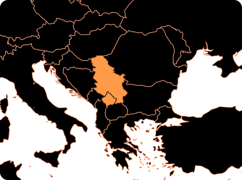
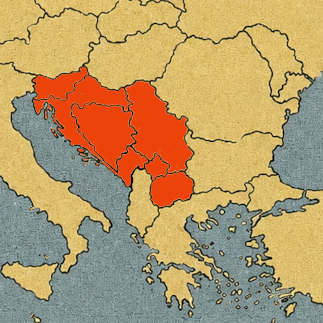
For decades, a country called Yugoslavia appeared on the maps of Europe. Today, that name no longer appears as a country. In its place we find several states: Slovenia, Croatia, Bosnia and Herzegovina, Serbia, Montenegro, and North Macedonia. And, in addition, Kosovo, whose independence is recognized by numerous countries but not by Serbia or all states.[1]
How can an entire country disappear from a map? The answer lies in a complicated history of borders, peoples, identities, politics, and wars. But it is also a story about something that maps usually hide: countries can change.
Yugoslavia was not always a single country with the same borders. It was born, changed its shape, survived a world war, and eventually ended up disintegrating. Its disappearance transformed the map of the Balkans.
A country with many pieces
The word Yugoslavia roughly means “land of the South Slavs.” The name fit an idea that began to gain strength during the 19th century: the South Slavic peoples of Europe shared linguistic and cultural ties and could form their own political community.
After the First World War, in 1918, the Kingdom of Serbs, Croats and Slovenes was born, which in 1929 was officially renamed the Kingdom of Yugoslavia.[2] Its territory brought together regions that had previously belonged to different empires and states.
After the Second World War, a new Yugoslavia appeared, this time as a socialist state led by Josip Broz Tito. The new federation was made up of six republics: Slovenia, Croatia, Bosnia and Herzegovina, Serbia, Montenegro, and Macedonia. Within Serbia there were also two autonomous provinces: Kosovo and Vojvodina.[3]
So Yugoslavia was not simply a huge region of a single people. It was a federation with different communities, religions, languages, traditions, and histories. And precisely that diversity would be very important when the country began to change.
Tito’s map
For decades, Yugoslavia occupied a very particular position in Europe. Tito ruled the country as a dictator (a dictator is a political leader who has total power over a country and exercises it without any democratic limitation or control) from the end of the Second World War until his death in 1980.
Yugoslavia was socialist, but it was not part of the Soviet bloc after the break between Tito and Stalin in 1948.[4] The country developed its own political and economic model and played a prominent role in the Non-Aligned Movement.[4]
When Tito died
Tito’s death in 1980 left the country without the figure that for decades had held the political system together. Yugoslavia then entered a period of economic problems, political tensions, and rising nationalism.[5]
Each republic had its own institutions and parties, and discussions on the distribution of power and resources became increasingly intense. Different ideas about the future also emerged. Some politicians advocated keeping a united Yugoslavia. Others wanted a different federation. And some movements argued that their republics should become independent states.
The map hadn’t changed yet. But the political lines holding it up were starting to shift.
The first major change
In 1991, Slovenia and Croatia declared their independence.[6] Macedonia—today North Macedonia—also declared its independence that year. The map that had remained the same for decades began to divide.
The disappearance of Yugoslavia was not a simple administrative decision. In some areas there were clashes, population expulsions, destruction of cities, and serious crimes against civilians. In Slovenia, the armed conflict was brief. In Croatia, the situation was much more violent and lasted for several years.[6]
Therefore, when we look at a current map and see new borders, it is important to remember that behind those lines there were people who had to leave their homes and entire communities that were destroyed.
But the most complex part was yet to come.
Bosnia and Herzegovina: a particularly difficult map
Bosnia and Herzegovina declared its independence in 1992. The territory had a very diverse population, with Muslim Bosniaks, Orthodox Serbs, Catholic Croats, and other communities.[7]
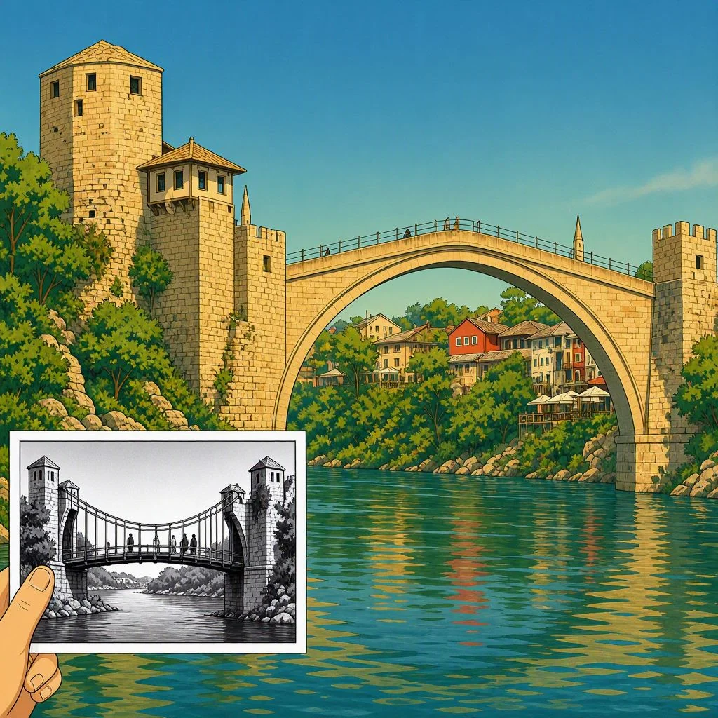
The war that followed was especially devastating. Sarajevo was subjected to a long siege. Cities and towns were destroyed. Thousands of people died and millions had to leave their homes.[7] One of the best-known symbols of that era was the Mostar Bridge.
A broken bridge
Mostar was famous for its old bridge over the Neretva River. The Stari Most, built in Ottoman times in the 16th century, joined the two banks of the city and had become one of its symbols.[8] In November 1993, during the war in Bosnia and Herzegovina, the bridge was destroyed by shelling.[8]
The bridge was rebuilt using traditional techniques and stones recovered whenever possible[8] and in 2004 it was reopened. In 2005, the Stari Most and the historic center of Mostar were inscribed on the UNESCO World Heritage List.[8] The bridge thus became another kind of symbol: something that had been destroyed could once again unite the two banks.
The map kept changing
In 1995, the Dayton Accords ended the conflict in Bosnia and Herzegovina.[9] Meanwhile, the Federal Republic of Yugoslavia had been reduced to Serbia and Montenegro.
And then another territorial issue appeared: Kosovo. During 1998 and 1999, violence between Serb/Yugoslav forces and the Kosovo Liberation Army escalated into a new war.[10]
In June 1999, following NATO intervention and the withdrawal of Yugoslav and Serbian forces, Kosovo was placed under an international administration established by UN Security Council Resolution 1244.[10]
The name Yugoslavia still existed. But it took up less and less space on the map.
The final chapter
In 2003, the Federal Republic of Yugoslavia officially disappeared and was replaced by a state union called Serbia and Montenegro.[11] The name Yugoslavia had ceased to exist as the official designation of a state.
Three years later, in 2006, Montenegro held a referendum on independence and subsequently became an independent state.[12] Serbia continued as an independent state. And the map changed again.
In 2008, Kosovo declared its independence.[13] Its international status remains disputed: numerous states recognize Kosovo as independent, while Serbia and other countries do not recognize it.[13]
How many countries came out of Yugoslavia?
When we talk about the countries that emerged from the former Yugoslavia, we usually find six internationally recognized states that come from the former federated republics:
- Slovenia
- Croatia
- Bosnia and Herzegovina
- Serbia
- Montenegro
- North Macedonia
And there is also Kosovo, which declared its independence in 2008 and whose international recognition is not universal.[1][13]
But there is an interesting detail. Current borders were not drawn from scratch. Many followed the administrative borders that already existed within Yugoslavia. That is, the lines that once separated republics within the same country became international borders. That is what makes the history of Yugoslavia so important for understanding maps.
It changed the maps
The history of Yugoslavia cannot be summarized simply by saying that “a country split up.” It was a much more complex process, marked by economic crises, nationalism, political decisions, wars, and international changes.[5][6][7]
Between 1991 and 2006, the political map of the Balkans was profoundly transformed. Yugoslavia disappeared and new states were born. Some internal borders became international borders. Some cities were divided by war and later tried to rebuild. And places like the Mostar Bridge remind us that a map is not made only of lines. It is made of people.
Therefore, when you look at a map of Europe again, look for an area with several small countries between the Adriatic and the interior of the Balkans. A few decades ago, much of that space had a single name: Yugoslavia. The country disappeared from the map, but it left behind one of the most important geographical transformations in contemporary Europe.
Sources:
1. European Parliament — States emerged from the former Yugoslavia and situation in Kosovo — https://www.europarl.europa.eu/factsheets/en/sheet/168/the-european-external-action-service
2. Encyclopaedia Britannica — formation of the Kingdom of Serbs, Croats and Slovenes and evolution towards Yugoslavia — https://www.britannica.com/place/Yugoslavia-former-federated-nation-1929-2003
3. Encyclopaedia Britannica — structure of socialist Yugoslavia and its six republics — https://www.britannica.com/place/Yugoslavia-former-federated-nation-1929-200
4. Encyclopaedia Britannica — Tito, Yugoslavia and the Non-Aligned Movement — https://www.britannica.com/biography/Josip-Broz-Tito
5. Encyclopaedia Britannica — political and economic crisis of Yugoslavia after Tito's death — https://www.britannica.com/place/Yugoslavia-former-federated-nation-1929-2003
6. Encyclopaedia Britannica — declarations of independence of Slovenia, Croatia and Macedonia and Yugoslav wars — https://www.britannica.com/place/Yugoslavia-former-federated-nation-1929-2003
7. United Nations — background and consequences of the war in Bosnia and Herzegovina — https://www.un.org/en/genocideprevention/bosnia.shtml
8. UNESCO — Old Bridge and historic center of Mostar, destruction and reconstruction — https://whc.unesco.org/en/list/946
9. U.S. Department of State — Dayton Accords and end of the Bosnian War — https://history.state.gov/milestones/1993-2000/dayton-accords
10. United Nations — Resolution 1244 and international administration of Kosovo — https://digitallibrary.un.org/record/274488?ln=es
11. Encyclopaedia Britannica — creation of Serbia and Montenegro in 2003 — https://www.britannica.com/place/Serbia-and-Montenegro
12. European Commission — independence of Montenegro and evolution of Serbia and Montenegro — https://neighbourhood-enlargement.ec.europa.eu/montenegro_en
13. International Court of Justice — 2010 advisory opinion on Kosovo's declaration of independence — https://www.icj-cij.org/case/141