Kosovo
Is Kosovo an independent country or not?
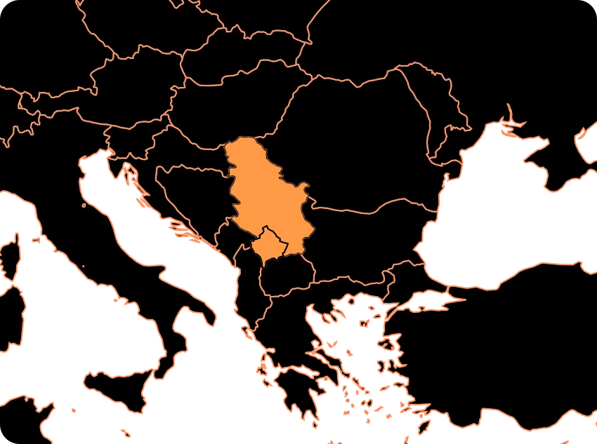
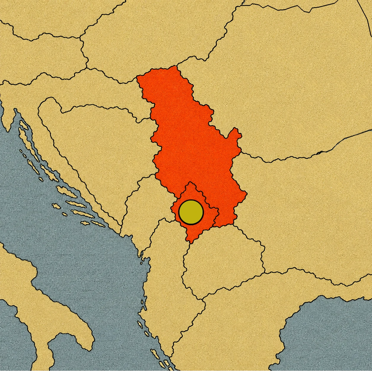
On maps, Kosovo can appear in different ways depending on who makes them. On some maps, it appears as an independent state. On others, it appears within the borders of Serbia. Some use a solid line; others prefer a dashed line or a note explaining its situation.
Why does this happen? Because Kosovo is one of those places where the map and politics do not tell the exact same story.
Kosovo declared its independence from Serbia on February 17, 2008. Since then, numerous states have recognized it as an independent state, while others do not. Serbia maintains that Kosovo is part of its territory and does not recognize the declaration of independence.[1][2]
That is why, to understand Kosovo, you have to learn something important about maps: a border drawn on paper does not always mean that all countries agree on what it represents.
What does “disputed territory” mean?
The expression might sound complicated, but the idea is simple.
A disputed territory is a space where political actors disagree about its sovereignty, status, or borders. That does not necessarily mean the whole territory is full of soldiers or that nobody knows who manages the roads, schools, or hospitals. It means there is a fundamental question that does not have the same political recognition for everyone.
In Kosovo, Kosovan institutions carry out government functions, and Kosovo presents itself internationally as an independent state. At the same time, Serbia does not recognize that independence and maintains its own legal position regarding the territory.[2][3]
In addition, five European Union member states—Cyprus, Greece, Romania, Slovakia, and Spain—do not recognize Kosovo’s independence either.[4] China and Russia do not recognize it either.[4]
So, a school map that wants to be careful must explain what it is representing.
When Yugoslavia began to break apart
To understand the problem, you have to go back a few decades. After World War II, Yugoslavia was formed as a federal state made up of several republics and territories with different histories, languages, and populations. During the 1980s and 1990s, the Yugoslav system went through a deep political and economic crisis. Relations between its different republics and communities deteriorated.
In the early 1990s, Slovenia, Croatia, Bosnia and Herzegovina, and Macedonia broke away from Yugoslavia, while Serbia and Montenegro continued to form the Federal Republic of Yugoslavia.
Kosovo had a different situation. It was not one of the six federated republics, but rather an autonomous province within Serbia. Its population was mostly Albanian, along with a significant Serbian population and other communities.
During those years, political tensions grew between the Serbian authorities and a large part of the Kosovo Albanian population. And Kosovo would eventually become one of the most difficult flashpoints.
The 1998–1999 war
In 1998 and 1999, violence between the forces of the Federal Republic of Yugoslavia and Serbia and the Kosovo Liberation Army (UÇK/KLA) increased significantly.[5] There was fighting, attacks against civilians, destruction of towns, and massive population displacement. The United Nations documented a severe humanitarian crisis and hundreds of thousands of displaced people during the conflict.[5][6]
In March 1999, NATO launched an air campaign against the Federal Republic of Yugoslavia. The operation lasted 78 days.[7] In June, the withdrawal of Yugoslav and Serbian forces from Kosovo began. The United Nations Security Council then approved Resolution 1244, which established the international framework for the new era.[7][8]
The territory entered a completely new situation.
An internationally administered territory
Resolution 1244 authorized an international security presence and an international civil presence in Kosovo.[8] The civil mission was named UNMIK, the United Nations Interim Administration Mission in Kosovo. Its task was extraordinary: to temporarily administer the territory, help establish self-government institutions, and create the conditions for a normal and safe life.[8]
At the same time, the international force KFOR, led by NATO under a mandate from Resolution 1244, deployed to help maintain security.[7] For years, Kosovo remained under a special international regime. It was not simply a province administered like any other part of Serbia. Nor was it yet an independently recognized state by everyone. It was a territory subjected to provisional international administration while discussions about its future status continued.[8]
2008: A new map
After years of negotiations and disagreements over Kosovo’s future, Kosovan authorities declared independence on February 17, 2008.[1] The new state began to establish its own institutions and seek international recognition.
But the declaration was not accepted by everyone. Serbia rejected it. Other states did too. That is why Kosovo entered a peculiar situation: for some countries, it was an independent state; for others, it was still part of Serbia.
In 2010, something important happened. Serbia had asked the UN General Assembly to consult the International Court of Justice (ICJ) on the legality of the declaration of independence. The Court issued its advisory opinion on July 22, 2010.[1] Its conclusion was very specific: the declaration of independence adopted on February 17, 2008, did not violate international law.[1]
But you have to understand what this decision really means. The Court was answering a specific legal question about the declaration of independence. Its opinion did not amount to an order for all countries to recognize Kosovo, nor did it resolve all political issues related to its status by itself.[1] Because of this, international disagreement continued.
A map can have more than one reading
This is where Kosovo becomes a true lesson in political geography. Imagine two atlases. In the first one, Kosovo appears with its own color and an international border. In the second one, the same territory appears inside Serbia, perhaps with an explanatory note. And neither of them is wrong!
It means that the two maps are using different political criteria to represent a situation about which there is international disagreement.
Maps are not just drawings. They decide which borders to highlight, what names to use, and what categories to employ.
Recognizing is not the same as controlling
Another important distinction is the one between recognition and control.
For a country to recognize Kosovo means it formally accepts its status as an independent state. That does not mean international recognition is identical to a state’s ability to exercise its institutions over every part of a territory.
In Kosovo, there are local institutions, while international organizations such as UNMIK and KFOR remain present.[3][7] In addition, relations between Kosovo and Serbia continue to be the subject of a dialogue facilitated by the European Union, whose stated goal is to move toward the normalization of their relations.[4]
So there are several overlapping layers: local government, international recognition, the positions of other states, international presence, and political negotiations.
A single color on a map can hardly explain all of that.
Disputed territory
Kosovo is a particularly clear example of why maps need explanations. Its recent history is linked to the dissolution of Yugoslavia, the 1998–1999 war, the subsequent international administration, and the 2008 declaration of independence.[1][5][8]
Today, Kosovo functions with its own institutions and is recognized as an independent state by many countries, but its independence is not universally recognized. Serbia maintains its territorial claim, and several states still do not recognize Kosovo.[2][4]
That is why, in an SGK atlas, a dashed line between Serbia and Kosovo can be a very useful tool. It does not say who is right. It simply communicates something essential to the reader: here there is a territorial issue that remains a matter of disagreement.
Sometimes, to understand a map, it is not enough to look at where one color ends and another begins. You have to understand why someone decided to draw that line.
Sources:
1. International Court of Justice — Advisory opinion of July 22, 2010 on the Kosovo declaration of independence — https://www.icj-cij.org/case/141
2. European Parliament — International status of Kosovo and states that do not recognize its independence — https://www.europarl.europa.eu/factsheets/en/sheet/168/the-european-external-action-service
3. United Nations, UNMIK — Mandate and evolution of the international mission in Kosovo — https://peacekeeping.un.org/es/node/104025
4. European Parliament — Kosovo-Serbia relations and status of international recognition — https://www.europarl.europa.eu/thinktank/en/academic/EPRS_BRI%282025%29779231
5. United Nations — Chronology and background of the 1998–1999 Kosovo conflict — https://www.un.org/unispal/document/auto-insert-179951/
6. UN Security Council — Resolution 1199 (1998), conflict and humanitarian crisis in Kosovo — https://press.un.org/en/1998/19980923.sc6577.html
7. NATO — Withdrawal of Yugoslav forces, deployment of KFOR, and end of the 1999 conflict — https://www.nato.int/en/news-and-events/articles/news/1999/06/10/kosovo
8. United Nations — Resolution 1244 (1999), international provisional administration and security presence — https://digitallibrary.un.org/record/274488?ln=es