
Palestine
The land of ancient stories
There are maps that look simple until you try to draw their borders. Palestine is one of them.
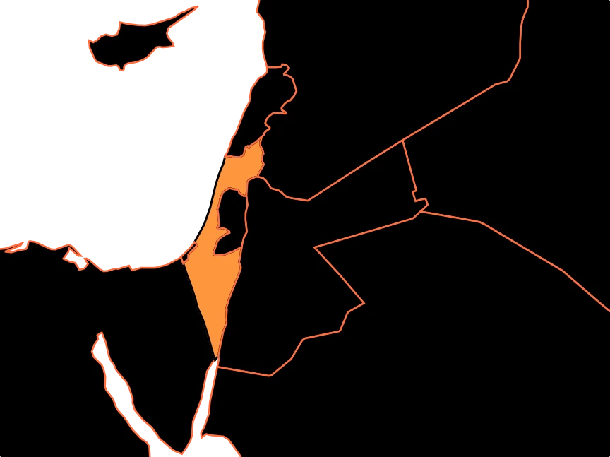
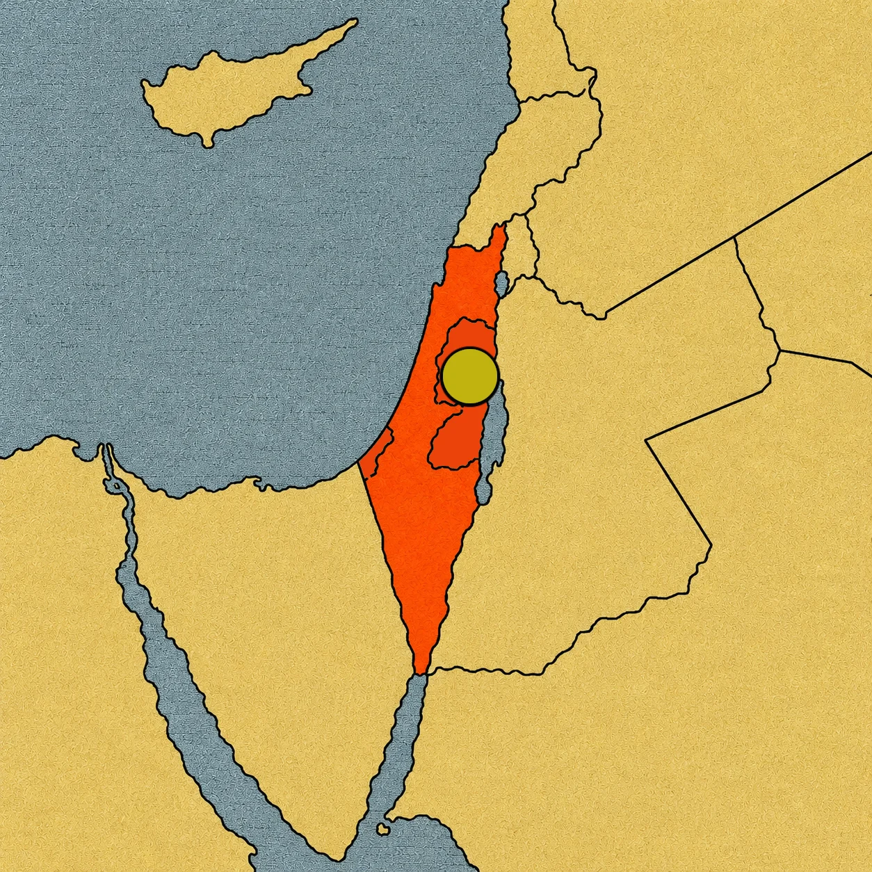
On a map, you can find two main territories associated with the State of Palestine: the West Bank, including East Jerusalem, and the Gaza Strip. But drawing a line around them does not answer every question. Who governs each area? Who controls security? What borders do they have? Which countries recognize Palestine? And what exactly does it mean for Palestine to have international recognition without being a full member of the United Nations?
Here, geography and politics are completely intertwined. That is why Palestine is a disputed territory: its land, its final borders, its political status, and the control over different parts of the region remain the subject of an international dispute.
First: what does “Palestine” mean?
The word Palestine can be used in different ways depending on the context.
It can refer to a historical region of the eastern Mediterranean. It can also designate the State of Palestine, the political entity proclaimed in 1988 and recognized by many countries. And, in United Nations language, it can appear linked to the Palestinian territory occupied since 1967: the West Bank, including East Jerusalem, and Gaza.[1][2]
This is important because territory, State, government, and control are not exactly the same thing. A map can show a region. A State can claim a territory. A government can administer some areas. And another actor can exercise military or administrative control over parts of that same space. All of these things can happen at the same time.
Two separate pieces
The West Bank and Gaza are not connected. The West Bank is a territory located west of the Jordan River. It has an area of about 5,600 km² and is mostly surrounded by Israel, while to the east it borders Jordan along the Jordan River. The Gaza Strip, on the other hand, is a narrow strip of land located next to the Mediterranean Sea. It borders Israel and Egypt.
Israeli territory lies between them. This creates a very unique geographic feature: the two main territories associated with the State of Palestine do not form a single continuous surface.[2] To picture it on a map, think of two pieces that belong to the same political story but are physically separated.
The West Bank does not have just one type of control
Here the map becomes much more complicated. The Oslo II Accords, signed in 1995, divided the West Bank into three administrative zones known as Areas A, B, and C.[3]
Area A mostly includes the largest Palestinian cities and most densely populated areas. The accords gave the Palestinian Authority broad civil and internal security powers there.
Area B also came under Palestinian civil administration, while the accords established a predominant Israeli responsibility for security.[3]
Area C comprises the rest of the West Bank and accounts for more than 60% of the territory. According to the system set up by Oslo, Israel maintains broad administrative and security powers there.[4]
So a map of the West Bank cannot simply color the whole territory in a single color. There are different areas, different degrees of administration, and different systems of access and security.
Does that mean Palestine has three borders?
No. And this is where one of the most important differences between administration and an international border appears. Areas A, B, and C were created through interim agreements between Israel and the Palestine Liberation Organization. They were not a final decision on the borders of a future Palestinian state.[3]
In fact, the Oslo Accords themselves left issues such as Jerusalem, settlements, refugees, and borders for permanent status negotiations.[3]
These are administrative and control divisions, not three different countries.
Jerusalem: a city that complicates the map even further
Jerusalem holds a special place. The eastern part of the city was captured by Israel in 1967 and later incorporated by Israel into its administrative system. However, the annexation of East Jerusalem is not recognized by the international community, and the city’s status remains one of the core issues of the conflict.[1][5]
For Palestinians, East Jerusalem is claimed as the capital of their future state. For Israel, Jerusalem is its capital. The United Nations has maintained that the final status of the city must be resolved through negotiations.[1] Therefore, when Jerusalem appears on a political map, it is not enough to look at who currently administers an area. You also have to distinguish between effective control, political claim, and international recognition.
And what is the State of Palestine?
This is another part that can be confusing.
In 2012, the United Nations General Assembly passed Resolution 67/19, which granted Palestine the status of a non-member observer state.[1] That is not the same as being a full member of the UN. But it also does not mean Palestine is simply an organization.
The international situation is more complex. According to a United Nations report from September 2026, 161 countries currently recognize the State of Palestine.[6] Other countries do not recognize it as a state. This is why a world map may show Palestine differently depending on the source and the criteria used.
Recognition does not mean control
This difference deserves a simple explanation. Imagine that many countries recognize an entity as a state. That recognition has a diplomatic and political dimension. But recognition does not automatically create a border on the ground.
It is one thing to say: “We recognize the State of Palestine.” It is another to answer: “Where exactly is its final border, and who controls every point of that territory?”
The first question is diplomatic. The second is territorial. And in the Palestinian case, both still lack an answer accepted by all parties.
Gaza: a small territory with a complex history
The Gaza Strip is much smaller than the West Bank, but its political importance is huge. Israel withdrew its settlements and permanent military forces from inside Gaza in 2005. In 2007, Hamas took internal control of the Strip following clashes with Fatah.[7]
Since then, the situation in Gaza has been marked by conflict, a blockade, and different forms of control and administration.
The war that began in October 2023 transformed the situation even further. As of September 2026, the United Nations continues to describe Gaza as part of the Occupied Palestinian Territory and notes that the transitional arrangements planned for Gaza were not yet fully operational.[8]
This shows why a map of Gaza needs a date. Control over a territory can change.
An occupied territory, according to the United Nations and the International Court of Justice
Legal terminology matters too. The United Nations uses the phrase Occupied Palestinian Territory to refer to the West Bank, including East Jerusalem, and Gaza.[8] In its advisory opinion of July 2024, the International Court of Justice considered that the Palestinian territory occupied since 1967 comprises the West Bank, East Jerusalem, and the Gaza Strip as a single territorial unit.[2]
The Court also concluded that Israel’s continued presence in that territory is illegal under international law and that the policies and practices analyzed violate the Palestinian people’s right to self-determination.[2]
These are conclusions from an international judicial body. Israel has rejected the findings of the advisory opinion and has defended its security needs and other legal arguments.[9]
Getting around the West Bank
Imagine you want to go to school, see the doctor, or visit your grandma in the next village. In almost any place, the question would be how long it takes. In the West Bank, it also depends on whether the road gate is open.
The United Nations documented 925 obstacles limiting the movement of about 3.4 million Palestinians in the West Bank, including East Jerusalem, as of December 2025. These include checkpoints, road gates, mounds of dirt, and roadblocks. In 2025, more than 120 new gates were installed, on top of mobile checkpoints—averaging about 15 a week. Many separate villages from main roads, and the UN points out that they make it hard to reach work, hospitals, or school.[10][11]
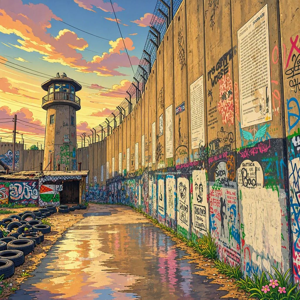
The Barrier. There is also a barrier of about 712 kilometers made of fences and walls, which mostly runs inside the West Bank rather than along the Green Line.[10] Each side calls it something different: Israel calls it a “security fence”; Palestinians usually call it a “wall”; and the UN calls it “the Barrier.”
Leaving the country. To travel abroad, most Palestinians from the West Bank cross into Jordan over a single bridge on the Jordan River, near Jericho, and fly out of Amman.[12] The crossing is controlled by Israel, which closes it during religious holidays or for security reasons.[13] Even the name changes depending on the side: Jordanians call it the King Hussein Bridge; Israelis call it Allenby; and Palestinians call it Al Karama.[14]
Why do these controls exist? Israel explains that they are security measures, created after the wave of attacks during the Second Intifada (2000–2005) to stop attackers from reaching Israeli cities, and maintains that they have reduced those attacks. In 2004, the Israeli Supreme Court accepted that a defensive barrier is lawful in principle, but ordered changes to sections that harmed the Palestinian population.[15] The UN and Palestinians highlight the impact on daily life. The International Court of Justice recognized Israel’s right to defend itself in 2004, but concluded that the sections built inside the West Bank are contrary to international law; Israel rejects that ruling.[11]
For some, these controls protect; for others, they turn a short trip into a mystery. Geography is not just lines on a map: how long it takes to get to school matters too.
A land with a very long history
Before modern borders, other maps existed. The region was part of different kingdoms and great empires: Assyrians, Babylonians, Persians, Hellenistic rulers, Romans, Byzantines, Islamic caliphates, Crusader states, Mamluks, and Ottomans, among others.
During the 20th century, the end of the Ottoman Empire and the British Mandate for Palestine led to new proposals for the political future of the region. In 1947, the UN General Assembly recommended a partition plan proposing the creation of an Arab state and a Jewish state, along with a special international regime for Jerusalem.[2]
The 1948 war changed the map. The 1967 war changed it again. The Oslo Accords introduced new administrative divisions. And the decades that followed transformed the territory once more. That is why there is no single historical map of Palestine. There are many.
Disputed territory
Palestine fits the definition of a disputed territory perfectly because it forces us to tell apart things that normally appear together on a map. There is the physical territory: the West Bank and Gaza. There is the State of Palestine, recognized by a vast majority of UN members, but still lacking full United Nations membership. There is the Palestinian Authority, which administers certain functions in parts of the West Bank. There is Israeli control, which reaches different degrees depending on the area and which, according to the United Nations and the International Court of Justice, takes place within the Occupied Palestinian Territory. And there are the final borders, which remain unagreed upon by the parties.
And that is the true lesson of Palestine: a map does not always show a single reality. Sometimes it needs multiple layers to explain a territory whose history is not yet finished.
Sources:
1. United Nations, status of Palestine as a non-member observer state and territorial and Jerusalem issues — https://www.un.org/unispal/document/auto-insert-187149/
2. International Court of Justice, advisory opinion of July 19, 2024 on the Occupied Palestinian Territory — https://www.icj-cij.org/index.php/node/204160
3. United Nations, Oslo II Accords: Areas A, B, and C and issues reserved for final status — https://www.un.org/unispal/document/auto-insert-185434/
4. United Nations, summary of the ICJ opinion on the administrative division of the West Bank and Area C — https://www.un.org/unispal/document/summary-of-the-icj-order-icj-19jul24/
5. United Nations, international status of Jerusalem and non-recognition of its annexation — https://www.un.org/unispal/document/auto-insert-187149/
6. United Nations, UNSCO report of September 2026: 161 countries recognize the State of Palestine — https://www.un.org/unispal/document/unsco-report-to-the-ad-hoc-liaison-committee-september-2026/
7. United Nations, historical context of Gaza and evolution of political control — https://www.un.org/unispal/
8. United Nations/OCHA, current situation of the Occupied Palestinian Territory and Gaza — https://www.un.org/unispal/document/unsco-report-to-the-ad-hoc-liaison-committee-september-2026/
9. International Court of Justice, advisory opinion and positions presented to the Court — https://www.icj-cij.org/index.php/node/204160
10. OCHA, Movement and Access in the West Bank, April 2026: ochaopt.org/content/movement-and-access-west-bank-april-2026
11. OCHA, movement and access update (May 2025), and the 2004 ICJ advisory opinion (cite directly): reliefweb.int/report/occupied-palestinian-territory/west-bank-movement-and-access-update-may-2025
12. Labour Friends of Israel, on traveling abroad: lfi.org.uk/steps-to-a-two-state-solution-ensure-palestinians-can-travel-abroad-more-freely/
13. CNN, on the crossing closure: abc17news.com/?p=1558011
14. Arab News, on the names of the bridge: arab.news/9vn9r
15. PBS Wide Angle, The World’s Most Complex Borders, covering the Israeli position and the 2004 ruling: pbs.org/wnet/wideangle/uncategorized/the-worlds-most-complex-borders-israelwest-bank/2328/